 |
|
|
Volume IX |
January 2004 |
Number I |
|
|
Loss of the Juan Bautista Valdez Grant: A Cautionary Tale By Mark SchillerUpdate on Rio Grande Corridor Plan Appeal |
Decision to Affirm Former Sangre de Cristo Land Grant Access Rights Stands By Kay Matthews Editorial: What is Worth Fighting For? By Kay Matthews |
Loss of the Juan Bautista Valdez Grant: A Cautionary TaleBy Mark SchillerEditor's Note: This is the first in a series of articles La Jicarita News will be doing in conjunction with the Land Grant History and Database Project. That project will trace the history of approximately 250 Hispano and Native American land grants in New Mexico from the Spanish and Mexican period through their adjudications by the federal government. With this series we hope to establish two major points. First, land grant history is extremely complex and the way a grant was used and by whom often evolved over time. Categorization of grants in terms of community or private ownership, therefore, must take into account the entire history of the grant, not just what was written in the grant documents or how a grant was initially formulated. Second, the Office of the Surveyor General and the Court of Private Land Claims often tried to reject or severely limit the extent of legitimate land claims in order to keep as much land in the federal domain as possible. We think this abbreviated version of the project's history of the Juan Bautista Valdez Grant near Abiquiú demonstrates both points. What came to be known as the Juan Bautista Valdez Grant actually consisted of three separate but related grants. The earliest of the three petitions was probably submitted in January or early February of 1807. The petition was apparently drafted by Valdez, a resident of Abiquiú, on behalf of himself and seven unnamed companions. It states that Valdez and his companions, with the permission of Alcalde (magistrate) Manuel Garcia, had cleared 2,000 varas (one mile) of land in Pedernal Cañon, about three leagues (nine miles) from Abiquiú, for the purpose of farming and requested that the land be granted to them. Governor Joaquin del Real Alencaster made the grant on 16 December 1807, briefly instructing Alcalde Garcia to put Valdez in possession of the requested land, to do whatever was necessary to assist him, and to make sure that the grant did not impair any third parties. The Act of Possession by Alcalde Garcia was dated 4 February 1807, Rio Arriba, which chronologically places it before the actual grant. This was probably a careless error and should have read 4 February 1808. This mistake, however, led to a controversy which subsequently affected the adjudication of this grant. The Act of Possession stated that the alcalde placed Valdez and his now nine companions in possession of a tract, subsequently referred to as Cañon de Riaño, San Miguel de los Cañones or Cañones, whose boundaries were: north, the boundary of the Martinez property (the Piedra Lumbre Grant); south, the source of the Pedernales River; east, the Rio Pedernales which abuts the boundary of the Polvadera Grant; west, the Mesa Blanca. These boundaries represented a much larger area than Juan Bautista Valdez requested in his petition and seem to imply that the governor and alcalde, without explicitly speaking about it in the concession or the act of possession, intended this extra land for community use. The lands referred to in the petition represented only the irrigable areas to be cultivated by Valdez and his companions, while the remaining uplands may have been intended as a commons or ejido for all the grantees to graze their livestock and access firewood and building materials. This interpretation is strengthened by genealogical work done by John Van Ness, which demonstrates that most of the settlers in this area, including the ranchos of the neighboring Polvadera and Piedra Lumbre grants, were related by blood or marriage and probably functioned as one large extended family. The second set of petitions consists of two "hijuelas" (a document outlining the division or transfer of property) drafted by Alcalde Pedro Ignacio Gallegos of Abiquiú on 5 July 1814. In these documents Gallegos stated that he met with Juan Bautista Valdez and Juan Antonio Gonzales "and the other individuals who were the settlers of San Miguel de los Cañones" who requested that he visit the grant. Gallegos reported that he did so and observed that the settlers did not have enough irrigable land to support their families. They requested that Alcalde Gallegos extend their holdings and issue hijuelas to each family. Alcalde Gallegos did this, but only the hijuelas issued to Valdez and Gonzales are extant. Valdez' tract (which became known as the Las Encinas tract because it was situated at the confluence of the Rio Encino and the Rio Puerco near present day Youngsville), in effect, placed a significant portion of the grant's western section in the name of Juan Bautista Valdez and was probably an acknowledgment of his elevated status within the community. The Gonzales hijuela extended Gonzales' irrigated lands fronting the the river by about a third of a mile (550 varas), but most importantly the alcalde wrote "The surplus that remained [within the 1807 grant boundaries] was left in favor of said settlers for pasture and watering places, which cannot be partitioned or sold to any person except one of the settlers." This final statement confirms that Alcalde Gallegos considered this a community grant with common lands reserved for the exclusive use of community members, which could only be conveyed among themselves. The third petition was submitted on 25 March 1824 by Francisco García, a resident of the jurisdiction of Abiquiú, on behalf of himself and fifteen other settlers from the same jurisdiction. Garcia stated that these settlers had been placed in possession of a tract of land near El Rito, but were being dispossessed because of a dispute over the acequia. In response, Governor Bartolomé Baca instructed the alcalde to find some land for the settlers in Riaño Cañon north of the current settlement. In April 1824 Alcalde Francisco Trujillo assigned tracts of approximately 150 varas of river frontage north of the 1807 grant boundary to each of the 16 petitioners and placed them in possession of it. Thus, in the two decades following the grant made in the name of Juan Bautista Valdez, a large number of settlers came to hold farm tracts along the Cañones Creek drainage and graze their livestock on the surrounding mountain pastures. In all, the farm tract owners totaled 35, and the population of the Cañones placita reached approximately 150. The initial petition for confirmation of this grant by the United States government was submitted to Surveyor General T. Rush Spencer in June 1871, but addressed only the Las Encinas tract, granted to Valdez in the hijuela of 1814. Attorney Samuel Ellison represented seven claimants who were grandchildren, or in one case the husband of a grandchild, of Juan Bautista Valdez, all of whom resided on the grant. In support of this petition Ellison submitted the 1814 hijuela, contending that it was an act of possession, which referenced and thereby evidenced the original 1807 grant. One of the petitioners, José Luís Valdez, testified that the original grant papers could not be found "after diligent search" and had been either "lost or destroyed". Based on the hijuela and oral testimony from the claimants, Surveyor General Spencer issued an opinion recommending the grant be confirmed by Congress. A preliminary survey of the Las Encinas tract was undertaken in 1879 and showed that it contained 6,583.29 acres. While this petition was still pending before Congress, the original grant was found and a second petition was submitted to Surveyor General Henry M. Atkinson on 10 August 1878 for what was referred to as the Cañon de los Pedernales Grant. This petition was submitted by Attorney John Gwyn, a well known land speculator, on behalf of virtually the same group of claimants that had petitioned for the Encinas Grant. After hearing oral testimony, Atkinson issued an opinion on 1 February 1879. A comparison of the signatures of Governor Alencaster and Alcalde Garcia on the grant documents with other documents in the archives convinced him the grant was genuine. However, he questioned the alcalde's authority to extend the grant beyond the boundaries Juan Bautista Valdez had requested in his original 1807 petition for farmland. Atkinson therefore recommended that only the land referenced in the petition within the Cañon de los Pedernales be confirmed, rather than the 256,000 acres the claimants contended were within the boundaries described in the 1807 act of possession. Moreover, because Valdez' companions were not specifically named in the original petition, Atkinson recommended that the grant be confirmed only to the heirs and legal representatives of Juan Bautista Valdez. With both the Las Encinas and Cañon de los Pedernales petitions pending before Congress, in December 1885 the General Land Office requested that the new Surveyor General, George W. Julian, reexamine both claims. In June and July of 1886 Julian issued separate opinions recommending both petitions be rejected. In his review of the Las Encinas tract Julian questioned the validity of the hijuela upon which the petition was predicated. He indignantly claimed "The records of this office furnish no evidence of there ever having been such a grant made [the original 1807 grant] and the only evidence upon the point is the meagre [sic] statement in the document above referred to [the Valdez hijuela]. This makes no reference to the date of the grant, by whom issued, or what land was granted, nor are there any facts stated which, if true, would show that any land was conceded." Julian was intentionally being misleading because he was well aware of the grant documents which accompanied the Cañon de los Pedernales petition. He goes on to say "besides, the land which is said to have been delivered to Baldez [sic] is so imperfectly described that its location would seem to be an impossibility." Once again Julian was being misleading because the tract had already had a preliminary survey and the surveyor had found all the boundaries referred to in the hijuela. Julian was even more rabid in his denunciation of the Cañon de los Pedernales claim stating that "a single reading of the unauthenticated title papers can scarcely fail to awaken suspicion and invite scrutiny." He went on to point out what he felt were inconsistencies in the grant documents: 1) that Valdez had petitioned for 2,000 varas within the Cañon, but the act of possession placed him and his companions in possession of a much larger tract; and 2) the date of the act of possession placed it before the date of the grant. Julian claimed that this could not be an error and was proof of the documents' fraudulence. He went on to say that the alcalde's act of possession was an "extension of land stealing which could rival the present day . . . . The whole story is so superlatively preposterous as to justify the suspicion that both the order of the Governor and the report of the Alcalde are the inventions of a later time and so clumsily planned as to expose their true characters. It is intrinsically improbable, if not morally impossible, that the circumstances of the case could have occurred as stated." While Julian was clearly implying that the grant papers were forged, he provided no proof to underwrite that claim other than the mistaken date. Surveyor General Julian's venomous and unfounded denunciations of these claims probably deterred Congress from taking further action on either petition and unquestionably influenced the outcome of the proceedings of the Court of Private Land Claims in which the two claims were combined and finally adjudicated. It should be noted, however, that Julian and Atkinson had ulterior motives in trying to dismiss these petitions or severely limit the amount of acreage confirmed. Two very large private grants, both made in the 1840s during the Mexican period when that government was trying desperately to secure its frontiers "by validating ownership through settlement", the Maxwell Grant, 1,714,765 acres, and the Sangre de Cristo Grant, 998,780 acres, had both been confirmed by Congress in 1860, very early in the New Mexico land grant adjudication process. After those confirmations, however, which resulted in enormous profits for land speculators associated with those grants, Congress realized vast tracts of land would be lost to the government if this process continued. It was thereafter understood that the Office of the Surveyor General had to deal more harshly with future petitions. Furthermore, the presumption that a grant was valid if a community had been established on it was summarily dismissed. More specifically, Atkinson and Julian's assertion that the alcalde did not have the authority to extend the grant boundaries beyond those referenced in the petition was false. If Governor Alencaster had not endorsed Alcalde Garcia's Act of Possession, he could have amended the boundaries or rescinded the grant. Both of those actions had historic precedent that the governor was surely aware of. The most important test of these grants' validity should have been whether they would have been held valid under Spanish and Mexican law. That standard, unfortunately, was not applied. In this case, Spanish and Mexican law was grossly misinterpreted by Atkinson and Julian, paving the way for the Court of Private Land Claims to later reject the Las Encinas tract and greatly diminish the Cañon de los Pedernales claim, both of which were valid. In March 1893 attorney N. B. Laughlin filed suit in the Court of Private Land Claims to confirm the combined petitions of the Las Encinas tract and the Cañon del los Pedernales Grant on behalf of José Luís Valdez, et al. The heirs of Valdez' companions and other settlers on the grant were not notified of the proceedings and the quasi-community nature of the grant was completely ignored. The case was not heard for over five years, but in July of 1897 the court appointed Thomas Coleman to visit the grant and investigate its boundaries. Coleman was able to locate the boundaries described in Juan Bautista Valdez' 1807 petition, but he also spoke with a number of area residents who indicated the grant extended far beyond the Cañon de los Pedernales to the west. Moreover, he found that most of the claimants, who believed they resided on the grant, lived and farmed land along the Encino Creek, well beyond the perimeters of the Cañon. The Court of Private Land Claims hearing finally took place on 8 June 1898. The Surveyor General's files and recommendations were reviewed, along with Coleman's report and oral testimony from grant residents concerning the boundaries. In its decision, the Court acknowledged the validity of the 1807 grant documents, but restricted the grant boundaries to the area within the Cañon described in Juan Bautista Valdez' 1807 petition. The boundaries outlined in the alcalde's 1807 act of possession were ignored, as was the oral testimony that indicated the claimants had been in continuous possession of an area that extended far beyond the limits of the Cañon. The Las Encinas claim was summarily rejected, and the area described in the 1824 grant was never considered. The adjudication of the Juan Bautista Valdez Grant by the Office of the Surveyor General and later the Court of Private Land Claims demonstrated a fundamental misunderstanding and gross misrepresentation of the Spanish and Mexican land tenure system by both those agencies, resulting in the loss of the vast majority of the grant. Thus, a legitimate quasi-community grant that probably consisted of more than 250,000 acres was reduced by the Court of Private Land Claims' decision to 1,468.57 acres and limited to the heirs and legal assigns of Juan Bautista Valdez rather than the community of settlers that occupied it. An official survey was completed 14 September 1899. Today the land surrounding the Cañon de los Pedernales is in the public domain and administered by the U.S Forest Service. Update on Rio Grande Corridor Plan AppealEl Bosque Preservation Action Committee filed an appeal of the Final Rio Grande Corridor Coordinated Resource Management Plan in February of 2000. Four years later the Office of Hearings and Appeals dismissed the appeal and upheld the Bureau of Land Management's Record of Decision on the Plan. The decision rendered by the appeals office is typical of land management agencies' failures to address several kinds of critical issues. First, agencies always claim they can "mitigate" any impacts that may occur because of their activities. El Bosque's concerns abut the safety on Highway 68 because of certain takeouts for commercial and private boating were summarily dismissed with the language "BLM will be working closely with Rio Arriba County and public safety agencies on emergency medical services and law enforcement issues." Second, they fail to acknowledge that once an area is included in the plan for potential development it almost always increases use. El Bosque objected to the fact that a traditional use area such as Lover's Lane is included in the plan as a main access site even though it is privately owned (the property owners at Lover's Lane have erected a locked gate). The appeals office apparently believes the plan's statement "there will be no landing on private lands except in emergencies or with landowner permission" adequately addresses the issue. Certain components of the plan have already been implemented, including some road closures, but the current drought has significantly reduced water levels and boating activity on the river, making implementation of parts of the plan moot.
|
ANNOUNCEMENTSEnsuring a Land Legacy for Future Generations Conservation Opportunities and Planning Tools for the Future of Your Land and Your Community A community forum sponsored by the Taos Land Trust, with generous support from the McCune Charitable Foundation Part I Saturday, January 31, 2004 9:00 am &endash; 4:30 pm (lunch provided) Juan I. Gonzales Agricultural Center 202 Chamisa Road (just north of the Sagebrush Inn), Taos 9:00: Coffee and Registration 9:30: Keynote, Palemon Martinez, Northern New Mexico Stockman's Association, Taos Valley Acequia Association, Valles Caldera Trust 9:45: Preserving Your Family Land and Family Wealth&emdash;The Wisdom of Estate Planning Presenter to be announced 10:15: Land Conservation Tools&emdash;Conservation Easements and Other Flexible Approaches to Accomplish Your Goals on Your Land, Ernie Atencio, Taos Land Trust 10:45: Dealing with Rising Land Values&emdash;Property Tax Assessments and How to Establish and Maintain Your Agricultural Exemption, Gerald Nichols, Taos County Assessor 11:15: Audience/Panel Discussion Noon: Lunch (provided by TLT) 1:00: Keeping Water on the Land&emdash;Water Banking and Other Conservation Tools for Acequias, Geoff Bryce, Taos Valley Acequia Association 1:30: Sustaining Land and Community Vitality&emdash;Using Modern Legal Strategies to Maintain Traditional Land Tenure and the Wisdom of Traditional Settlement Patterns, Moises Gonzales, Rio Arriba County Planning Department & Mexicano Land Education and Conservation Trust 2:00: Additional Incentives for Land Conservation&emdash;Tax Credits under the New Mexico Land Conservation Incentives Act, Edward Archuleta, New Mexico Natural Lands Protection Committee 2:30: Financial Assistance to Keep Your Land in Agriculture&emdash;The USDA Farm and Ranch Lands Protection Program and Other NRCS Programs to Conserve Private Land, David Manzanares, RC&D Coordinator & District Conservationist, USDA Natural Resources Conservation Service 3:00: Panel Discussion 3:30: Audience Breakout Sessions/Roundtable Discussions 4:15: Closing Remarks 4:30: Adjourn (The second forum will be held on February 27. The agenda will be in the February issue of La Jicarita News and on the web.) Treaty of Guadalupe Celebration at the Oñate Center The Oñate Monument and Visitors Center will celebrate the Treaty of Guadalupe Hidalgo on Saturday, January 31, with lunch and an afternoon presentation. Director Norman Martinez will present power point historical summaries of three Rio Arriba land grants: Abiquiú; Piedra Lumbre; and Juan Bautista Valdez. They are some of the first summaries that have been completed by Martinez and the land grant history and data base team that hopes to assemble narratives of all the state's land grants over the next few years. There will also be a panel that will speak more specifically about several of the grants. Lunch will be served at 12:00 pm, with the presentations due to begin at 1:00 pm. For more information call the Oñate Center at 505 852-4639.
• A Democratic Presidential Candidates' Forum will take place on January 15th at 7 pm at the Dixon Elementary school gymnasium. Representatives of all candidates have been invited. For more information, call 579-4095. • The U.S. Small Business Administration (SBA) is offering low Economic Injury Disaster Loans to businesses in some New Mexico counties to offset losses due to drought and insect infestation that occurred from January 31, 2003. Due to the weather, many producers experienced crop losses and were unable to purchase goods and services at normal levels and businesses dependent upon these producers may be eligible for loans under this program. Businesses in the New Mexico counties of Colfax, Rio Arriba, San Juan, Taos, and Union can apply (farmers and ranchers are not eligible for this loan program but may be eligible for disaster assistance through other federal agencies). To find out more about the loans call the SBA toll free at 1-800-366-6303 or TDD 817-267-4688. The deadline is July 21, 2004. • The Valles Caldera is open for winter activities three days a week, Friday, Saturday, and Sunday. Daytime cross-country skiers and snowshoers must pay a day use fee of $10 for adults, $5 for youths 15 and under, and a 20 percent discount for seniors over 62 and groups of four or more. Fees may be paid in advance via the web site, www.vallescaldera.gov or can be purchased at the road-side warming hut, located on a parking turn-out on SH 4 between mile marker 39 and 40. Those who want to ski the Banco Bonita area may come directly to the Banco Bonito gate on SH 4 near mile marker 30 and pay their fees at the warming hut there. Full-moon horse-drawn sleigh rides will be offered in January, February and March for $20 for adults, $10 for youths and a 20 percent discount for seniors and groups of four or more. For more information call 1-877-851-8946. The Valle Caldera weatherline is 505-661-3333, ext. 3. • The Quivira Coalition's 3rd Annual Conference, January 15-17 at the Albuquerque Hilton. For more information call 820-2544. • The New Mexico Organic Farming & Gardening Expo on February 13 and 14 at the University of New Mexico Student Unions Building. For more information call 841-9070, ext. 4. Decision to Affirm Former Sangre de Cristo Land Grant Access Rights StandsBy Kay MatthewsThe United States Supreme Court declined to hear an appeal of the 2002 Colorado Supreme Court ruling that granted landowners who are the successors in title to the original settlers of the Sangre de Cristo Land Grant access rights to former grant lands (see La Jicarita, August 2002).The case had already lasted 21 years, and this appeal by the owner of a portion of the grant known as the Taylor Ranch, in the San Luis Valley of southern Colorado, was the last attempt to deny grant heirs their right to graze cattle and cut firewood and timber on the 80,000 acre ranch. Maria Mondragon Valdez, a longtime activist involved in the suit, said after the Colorado Supreme Court victory: "The devil is in the details and we have our work cut out for us figuring out how to make 19th century traditional use rights fit 21st century reality." Ray Otero, who has been involved in the case since the mid 1970s, explains: "We have to come up with a plan to utilize the land but not destroy it. The private owners extensively logged the mountain and essentially destroyed the watershed. It will be our responsibility to come together in a cohesive effort to educate the community so that we all treat the mountain with respect." 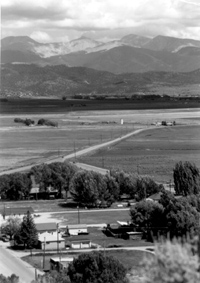 The high mountain peaks of the former Sangre de Cristo Land Grant above the town of San Luis The Land Rights Council, representing many of the people who have been involved in the case since the 1970s, has been working to raise money to underwrite the cost of developing a master plan for the land since the Colorado Supreme Court decision was handed down. The decision states that the landowners must engage in "reasonable use" of the grant. The Council would like to hire historians to research traditional uses of the grant through the years 1850 to 1900. The Council would also like to hire a group of ecologists to take a look at on-the-ground conditions in the traditional use zones to assess impacts from previous uses such as timbering and grazing. The Taylor Ranch was extensively logged under ownership of the Taylor family, and it is unclear how much erosion and habitat disruption have occurred. The scientists will help the Council develop a sustainable resource management plan for the land. Both Valdez and Otero stress how important it is that land owners who have access to the former grant under the terms of the court decision work cooperatively to insure that use is sustainable and appropriate. In the meantime, however, the court is going to have to determine what land owners actually have access rights to the ranch. There are many more people who have use rights than those identified by Jack Taylor (former owner of the ranch) in the abstract title to his land. The court will have to rule on whether access rights should be extended to all those who can trace land ownership within the grant, which includes families of the traditional villages of the Culebra River drainage and could number more than 1,000 people. The issue is complicated by the fact that many original landowners have left the village because of economic hardship, while others who have bought land in the valley have no connection to the original heirs. The defendant in the case, current ranch owner Lou Pai, will have to pay the costs of the title search. During the year and a half since the Colorado Supreme Court decision, the Land Rights Council made an effort to negotiate with Pai (his ranch is now officially known as the Jaroso Creek Ranch and Culebra Ranch). According to Valdez, however, because of the restrictions and gag order placed on the participants, Land Rights Council representatives eventually quit and negotiations fell apart. "If Lou Pai were smart," Valdez says, "he'd cede some of the land to us now." Valdez went on to say, "I personally think justice would best be served by putting the land in the public domain for multi-generational use. Grazing is coming to an end for many people. Others would like to be able to hunt, fish, and recreate on the land. Or if there is resistance in turning it over to someone like the Forest Service, maybe we could come up with some kind of 'quasi-public space' concept that would be equitable for everyone." Editorial: What is Worth Fighting For?By Kay MatthewsIn last month's La Jicarita News I wrote an editorial about the attempts of Chicago developer J.D. Holdings to acquire land in Taos County for a Super Wal-Mart. Since then, several newspaper articles have appeared quoting the company's spokesperson that the developer had "secured" most of the necessary 40 acres at the junction of SH 68 and 518 in Ranchos de Taos. I decided to find out for myself. I called Juan Valerio, who owns the several acres where the Valerio mall is located on SH 68, to see what he had to say about the company's attempt to buy his land. Valerio, as many of you know, is a former Taos County commissioner who served the southern part of the county from 1969 to 1980. He is now 81 years old and didn't hesitate to tell me "I will sell my land to whoever will give me the most money. All of you out there preaching about the culture and tradition of Taos don't know anything about what it really used to be. It's already destroyed. Our land has been taken from us, as well as our knowledge of the past." But he also stressed that he hadn't committed to selling to J.D. Holdings or anyone else, and believed that to be the case of most for his neighbors. He blamed the city for missing its chance to build a Super Wal-Mart within the city limits and claimed that the county commission "would be crazy" not to approve a superstore because of the income it would generate. He cautioned the city not to consider annexing the county land being considered as a Wal-Mart site, as the Los Ranchos area already has funding for sewer and water lines and is adamantly opposed to annexation. Valerio feels very differently about his water rights, however. As mayordomo of the Acequia Madre de Rio Chiquito for 30 years, he wants to see his water rights "stay in the Taos Valley." He is conversant with the new law allowing acequias to make provisions to bank water rights and told me "I think the ditch will get together to preserve our water rights." He admitted that some of those rights are already contested; much of the irrigated land is now trailers and houses and some of the parciantes are delinquent in their acequia dues. According to Valerio, the developer has never said anything to him about buying water rights. Valerio has previously been engaged in struggles to retain water rights and has a long history as a Serna Land Grant heir who fought and defeated the Forest Service when it denied heirs access rights to springs on the grant. His long activist history and current cynicism about Taos may seem contradictory, but as I spoke with him it became clear that the changes he has witnessed and the defeats he has experienced in his life-long home, coupled with his age, have turned an already feisty man&emdash;"I hate for anyone to push me around or tell me what to do"&emdash;understandably bitter. His daughter, Trudy Valerio Healy, who is currently active in acequia issues and the state water planning process, understands his position. "When I spoke with my dad about selling his land I decided I wouldn't tell him what to do. He spent his whole life trying to protect Ranchos, to take care of the acequia, and to save people's land. What I told him was 'This town doesn't deserve you.' " Juan Valerio sees Taos as a community already lost. He sees his people as a minority, overrun by "outsiders", tourism, galleries, and big business: "Smith's, Super-Save, Raley's, they aren't local businesses. What difference does it make if Super Wal-Mart comes in now. At least the people will have a place to shop instead of going to Española." Valerio's feelings, of course, come from a great sense of loss. But they leave no room for the rest of us who have a stake in protecting the community as it now exists. While many of us do not share the past that Valerio mourns, we do share his values: the importance of community, where neighbors know and help each other; of maintaining the acequia system that supports our agricultural, social, and ecological land base; of shopping at small, locally owned businesses and businesses that may not be locally owned but pay living wages and provide health care benefits. We are well aware of the threats that mega-corporations like Wal-Mart pose to equality and justice and must make decisions about what is worth fighting for based on these values and our personal commitment to working for a better world (Wal-Mart family owners are among the very richest people in this country and pay some of the lowest retail wages). I'm sure Juan Valerio would agree that no one wants to be "pushed around or told what to do," especially by Wal-Mart. Think New Mexico Recommends Strategic River ReserveThink New Mexico, a "results-oriented think tank" founded in 1999, tackles specific problems facing New Mexico and develops what it calls "effective, comprehensive, sustainable solutions." Previously, the group took on education; in 2003, it took up the issue of water and has developed a plan for what it calls a Strategic River Reserve. Think New Mexico cites the model of the Strategic Petroleum Reserve, created by Congress in 1975 to counter the effect of the 1973-74 oil embargo by establishing an emergency oil reserve. A Strategic River Reserve would consist of a pool of publicly held water rights on every river system, selected by the Water Trust Board (WTB) and paid for with the proceeds generated by a share of the state's annual severance tax bonding capacity or by a fee on water transfers. The group thinks that the WTB, established in 2001 by the state legislature to oversee water infrastructure projects across New Mexico, would be the appropriate agency to select water rights for purchase on behalf of the Strategic River Reserve because of the diversity of its makeup. It is comprised of representatives of the state's major stakeholders including acequia and irrigation communities, Native Americans, environmentalists, and various state agencies. The Interstate Stream Commission (ISC) would be responsible for monitoring the rights. To supply the Strategic River Reserve, the WTB would have to purchase water rights from willing sellers, as the ISC is currently trying to do on the Pecos River to meet Rio Grande Compact obligations. While recognizing that New Mexico already has an active water market (there are 100 applications for water transfers each year), the group emphasizes that the WTB would be restricted from acquiring water rights from acequias "because of [their] unique, social, cultural, and ecological benefits." Priorities would be established to meet the state's most urgent needs, for example, ensuring that the first acquired water rights help meet compact obligations, then protect the state from federal lawsuits made under the Endangered Species and Clean Water acts, and finally "enhance economic development interests like fisheries and river tourism." The group also recommends that senior water rights should be chosen over junior ones, that there be a wide geographic distribution of rights across the state, and where a crisis seems most imminent. Other than purchasing rights, Think New Mexico also recommends leasing water from entities that hold more water rights than they use, such as farmers who are not currently irrigating; setting up water trusts to seek donations of water rights; and dedicating conserved water to the reserve. In its analysis of how the state would pay for the reserve, the group identifies the severance tax bonding capacity used for the annual "Christmas Tree Bill" that pays for a variety of capital outlay or "pork" projects. The group believes the bonding capacity could better serve the needs of a Strategic River Reserve and proposes that the legislature set aside a 10% share towards bonds that would be used to fund the reserve. A second way to fund the reserve would be to impose a fee on water transfers, similar to a real estate transfer fee. According to Think New Mexico, "A transfer fee would alleviate some of the negative third party effects caused by transfers by having those who benefit from the sale&emdash;the buyer and the seller&emdash;absorb the costs of the public water rights needed to solve problems created by the transfer." It also recommends that the fee be progressive, increasing as the size of the water transfer increases. The group claims that currently New Mexico's water transfer transaction costs are well below those of neighboring states. For more information or to get a copy of the report "The Need for a Strategic River Reserve in New Mexico" you can contact Think New Mexico at 505 992-1315 or by e-mail at info@thinknewmexico.org.
|
Home | Current Issue | Subscribe | About Us | Environmental Justice | Links | Archive | Index
Copyright 1996-2002 La Jicarita Box 6 El Valle Route, Chamisal, New Mexico 87521.